
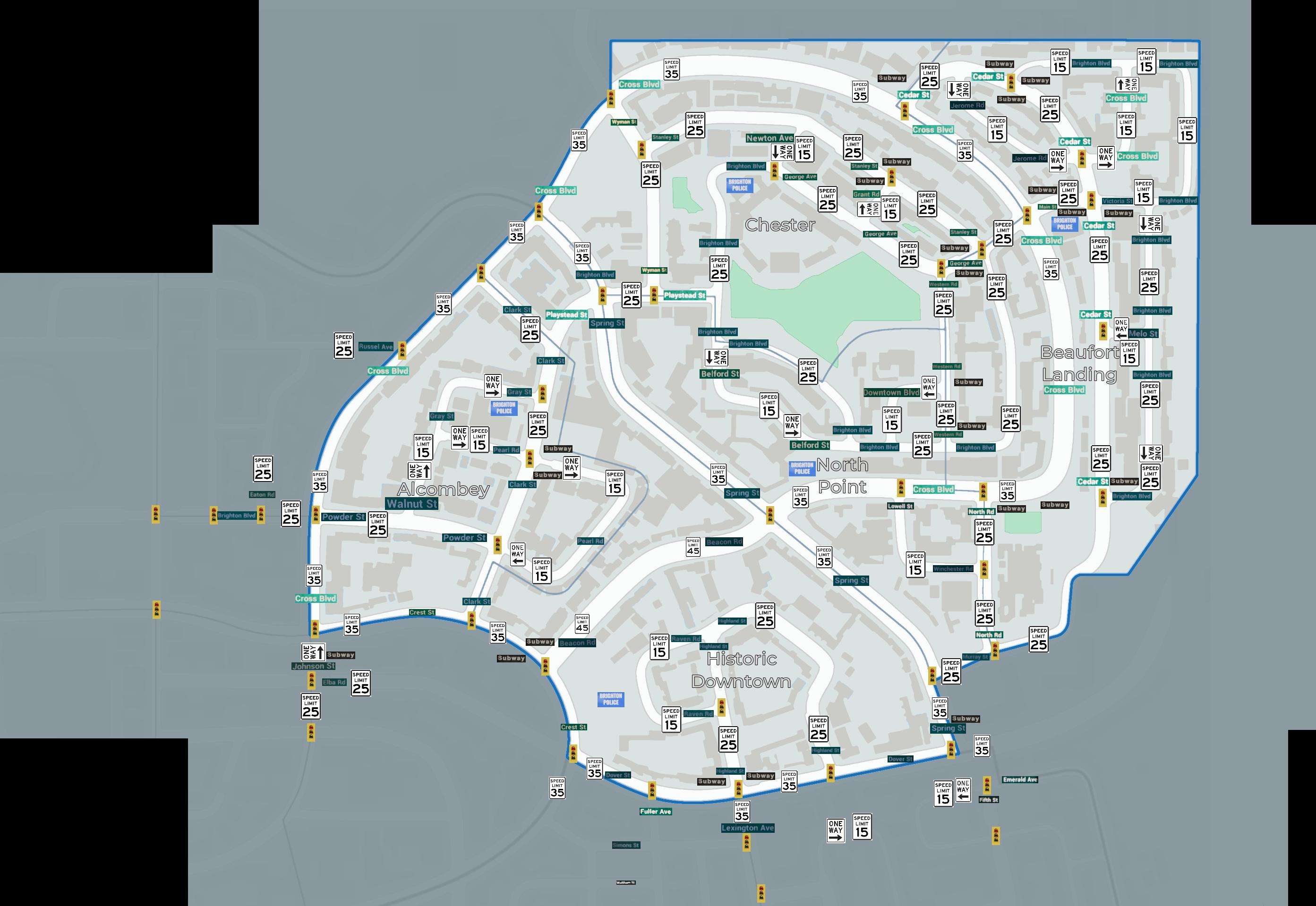
Reference Map
Each district’s streets are identified on the map, along with their names, any one-way streets that may be present, stop signs, and the posted speed limit.
Notes:
- Subway is the rough area of where the subway appears.
- Police is roughly where the station is at.
- Out Of Bounds Icons were within the warning zone with ample room to gather that data. Expect better data when those districts are released.
- This took a few days of Foot Patrol’s and Car Patrol’s to gather the map data.
Click to enlarge…
Be the first to comment